Mount Everest (Sagarmatha)

Overview:
- Height: 8,848.86 meters (29,031.7 feet)
- Location: Border between Nepal and China (Tibet)
- Coordinates: 27.9881° N, 86.9250° E
- First Ascent: May 29, 1953, by Sir Edmund Hillary (New Zealand) and Tenzing Norgay (Nepal)
Name and Significance:
Local Names:
- Sagarmatha (Nepali)
- Chomolungma (Tibetan)
Meaning:
- "Sagarmatha" translates to "Forehead in the Sky."
- "Chomolungma" means "Goddess Mother of the World."
Geography:
- Region: Khumbu Mahalangur Himalaya range
- Prominence: Everest has a topographic prominence of 8,848 meters, making it the tallest mountain above sea level.
Climbing Routes:
- South Col Route: The most popular route, starting from Nepal. It involves climbing through the Khumbu Icefall, Western Cwm, and Lhotse Face before reaching the South Col and the summit.
- Northeast Ridge Route: The main route from Tibet, involves a climb from the north side through the Rongbuk Glacier, up the North Col, and along the Northeast Ridge.
Base Camps:
- South Base Camp: Located in Nepal at an altitude of 5,364 meters (17,598 feet).
- North Base Camp: Located in Tibet at an altitude of around 5,150 meters (16,900 feet).
Climbing Seasons:
- Spring (April to May): The most popular climbing season due to favorable weather conditions.
- Fall (September to November): Less popular but still viable, often with fewer climbers.
Challenges:
- Altitude Sickness: The high altitude poses significant risks of Acute Mountain Sickness (AMS), High Altitude Pulmonary Edema (HAPE), and High Altitude Cerebral Edema (HACE).
- Weather Conditions: Sudden weather changes, extreme cold, and strong winds can make climbing dangerous.
- Khumbu Icefall: One of the most dangerous sections of the South Col route, known for its shifting ice and crevasses.
Environmental and Ethical Considerations:
- Pollution: Increasing numbers of climbers have led to concerns about waste and litter on the mountain.
- Conservation Efforts: Initiatives have been launched to clean up the mountain and promote sustainable climbing practices.
Cultural Impact:
- Tourism: Everest attracts thousands of trekkers and climbers annually, significantly contributing to Nepal's economy.
- Symbolism: The mountain is a symbol of human aspiration and challenge, drawing adventurers worldwide.
Notable Records:
- First Ascent Without Supplemental Oxygen: Reinhold Messner and Peter Habeler, 1978.
- Fastest Ascent: Pemba Dorje Sherpa claimed to summit in 8 hours and 10 minutes in 2004 (disputed).
- Most Summits: Kami Rita Sherpa holds the record for the most summits, with 30 ascents as of May 2024.
Mount Everest continues to captivate and challenge climbers with its formidable height and treacherous conditions, standing as a testament to human endurance and the spirit of exploration.
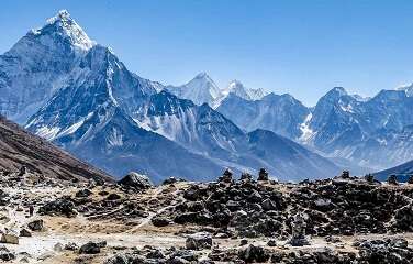
EVEREST REGION TREKS
- Everest Base Camp Trek
- Everest Gokyo Lake Trek
- Everest Three Passes Trek
- Everest Short Panorama View Trek
Kanchenjunga
.jpg)
Overview:
- Height: 8,586 meters (28,169 feet)
- Location: Border between Nepal and the Indian state of Sikkim
- Coordinates: 27.7025° N, 88.1475° E
- First Ascent: May 25, 1955, by Joe Brown and George Band (UK)
Name and Significance:
Local Names:
- Kangchenjunga (Sanskrit and Tibetan origin)
Meaning:
- "The Five Treasures of Snows," refers to its five peaks representing gold, silver, gems, grain, and holy books.
Geography:
- Region: Part of the Himalayas
- Prominence: The third highest mountain in the world, Kanchenjunga has a prominence of 3,922 meters.
- Peaks: The Kanchenjunga massif comprises five main peaks:
- Kanchenjunga Main: 8,586 meters
- Kanchenjunga West (Yalung Kang): 8,505 meters
- Kanchenjunga Central: 8,482 meters
- Kanchenjunga South: 8,494 meters
- Kangbachen: 7,903 meters
Climbing Routes:
- Southwest Face Route: The most common route, which starts from the Yalung Glacier in Nepal.
- North Face Route: Another prominent route, typically approached from the Sikkim side, though climbing from the Indian side is currently restricted.
Base Camps:
- South Base Camp: Located in Nepal, serves as the starting point for the southwestern face route.
- North Base Camp: Located in India, though access is limited due to border and environmental regulations.
Climbing Seasons:
- Spring (April to May): The most favorable season for climbing due to more stable weather conditions.
- Fall (September to November): An alternative season with fewer climbers, but the weather can be more unpredictable.
Challenges:
- Remote Location: Kanchenjunga is less accessible than other 8,000-meter peaks, making expeditions more challenging and expensive.
- Severe Weather: Known for extreme weather conditions, including heavy snowfall and strong winds.
- Technical Difficulty: The climb involves complex glacier navigation, steep ice, and rock climbing sections.
Environmental and Ethical Considerations:
- Sacred Mountain: Kanchenjunga is considered sacred by the indigenous people of Sikkim and eastern Nepal. Climbers traditionally stop short of the summit out of respect.
- Conservation Efforts: Both Nepal and India have established conservation areas to protect the unique flora and fauna around the mountain.
Cultural Impact:
- Tourism: While not as popular as Everest, Kanchenjunga attracts climbers and trekkers looking for more remote and challenging adventures.
- Symbolism: The mountain holds spiritual significance for local communities, often associated with deities and myths.
Notable Records:
- First Female Ascent: Ginette Harrison (UK), 1998.
- Notable Climbers: Reinhold Messner, the first to climb all fourteen 8,000-meter peaks, included Kanchenjunga in his list of ascents.
Kanchenjunga remains a symbol of the majestic and challenging nature of the Himalayas, offering both breathtaking beauty and formidable obstacles to those who attempt to reach its lofty heights.
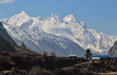
KANCHENJUNGA REGION TREKS
Lhotse
.jpg)
Overview:
- Height: 8,516 meters (27,940 feet)
- Location: Border between Nepal and China (Tibet)
- Coordinates: 27.9617° N, 86.9330° E
- First Ascent: May 18, 1956, by Ernst Reiss and Fritz Luchsinger (Switzerland)
Name and Significance:
- Local Name: Lhotse, which means "South Peak" in Tibetan.
- Notable Features: Lhotse is part of the Everest massif and is the fourth-highest mountain in the world. It is connected to Mount Everest via the South Col.
Geography:
- Region: Located in the Mahalangur range of the Himalayas.
- Prominence: Lhotse has a topographic prominence of 610 meters.
- Peaks: The Lhotse massif includes three main peaks:
- Lhotse Main: 8,516 meters
- Lhotse Middle: 8,414 meters
- Lhotse Shar: 8,383 meters
Climbing Routes:
- Lhotse Face: The most famous and challenging section for climbers ascending Lhotse and Everest from the south side.
- Standard Route: The primary route to the summit is via the western flank and the Lhotse Face, starting from Everest's South Col.
Base Camps:
- South Base Camp (Nepal): The same base camp used for the southern route to Everest, located at 5,364 meters (17,598 feet).
Climbing Seasons:
- Spring (April to May): The most popular climbing season with more stable weather conditions.
- Fall (September to November): An alternative season, though with potentially more challenging weather.
Challenges:
- Lhotse Face: A steep, glaciated face that climbers must ascend to reach the higher camps. The face is notorious for its technical difficulty and the risk of avalanches.
- Altitude: Climbers face the same risks of altitude sickness as on other 8,000-meter peaks.
- Weather: Sudden changes in weather, strong winds, and extreme cold make climbing Lhotse particularly hazardous.
Environmental and Ethical Considerations:
- Crowding: Due to its proximity to Everest, Lhotse can experience similar issues with overcrowding, particularly at the shared base camp and on the lower slopes.
- Waste Management: Increased efforts are being made to manage waste and minimize the environmental impact of expeditions.
Cultural Impact:
- Tourism: Lhotse attracts experienced climbers, often those who have previously summited Everest and are looking for a new challenge.
- Symbolism: As part of the Everest massif, Lhotse shares much of the cultural and symbolic significance associated with Everest.
Notable Records:
- First Ascent Without Supplemental Oxygen: Lhotse was first summited without supplemental oxygen by Reinhold Messner and Hans Kammerlander in 1986.
- Fast Ascent: Ueli Steck set a record for a solo ascent of the Lhotse Face in just 10 hours and 30 minutes in 2011.
Lhotse remains one of the most prominent and challenging peaks in the world, drawing climbers with its close association to Everest and its own formidable difficulties.
Makalu
.jpg)
Overview:
- Height: 8,485 meters (27,838 feet)
- Location: Border between Nepal and China (Tibet)
- Coordinates: 27.8897° N, 87.0883° E
- First Ascent: May 15, 1955, by Lionel Terray and Jean Couzy (France)
Name and Significance:
- Local Name: Makalu, which is derived from the Sanskrit word "Maha-Kala," meaning "Big Black."
- Notable Features: Makalu is the fifth-highest mountain in the world, known for its distinctive pyramid shape and sharp ridges.
Geography:
- Region: Located in the Mahalangur range of the Himalayas, 19 kilometers southeast of Mount Everest.
- Prominence: Makalu has a topographic prominence of 2,386 meters.
- Peaks: The Makalu massif includes two notable subsidiary peaks:
- Kangchungtse (Makalu II): 7,678 meters
- Chomo Lonzo: 7,804 meters
Climbing Routes:
- Northwest Ridge: The standard route, which is highly technical and involves climbing steep pitches of rock and ice.
- Southeast Ridge: A less commonly used but equally challenging route.
Base Camps:
- Makalu Base Camp: Located in Nepal at an altitude of approximately 4,800 meters (15,750 feet).
Climbing Seasons:
- Spring (April to May): The most favorable season for climbing due to stable weather conditions.
- Fall (September to November): An alternative season with fewer climbers, though weather can be more unpredictable.
Challenges:
- Technical Difficulty: Makalu is considered one of the most difficult 8,000-meter peaks to climb, with exposed ridges, steep climbs, and knife-edged passes.
- Altitude: Climbers face significant risks of altitude sickness, similar to other high Himalayan peaks.
- Weather: Harsh and rapidly changing weather conditions, including severe cold and strong winds.
Environmental and Ethical Considerations:
- Remote Location: Makalu's remoteness adds to the challenge, making logistics and rescue operations difficult.
- Conservation Efforts: Efforts are ongoing to preserve the natural environment around Makalu, which is part of the Makalu Barun National Park in Nepal.
Cultural Impact:
- Tourism: While less frequented than Everest, Makalu attracts experienced climbers seeking a challenging ascent away from the more crowded peaks.
- Symbolism: The mountain holds cultural significance in the region, embodying both natural beauty and spiritual meaning.
Notable Records:
- First Winter Ascent: Makalu was first climbed in winter by a French expedition in 1980.
- Fastest Ascent: Some notable speed records have been set by climbers who specialize in rapid ascents without supplemental oxygen.
Makalu's imposing presence and formidable challenges make it a sought-after goal for serious mountaineers, offering a test of skill, endurance, and resilience amidst the breathtaking landscapes of the Himalayas.
MAKALU REGION TREK
Cho Oyu

Overview:
- Height: 8,188 meters (26,864 feet)
- Location: Border between Nepal and China (Tibet)
- Coordinates: 28.0944° N, 86.6608° E
- First Ascent: October 19, 1954, by Herbert Tichy, Joseph Jöchler (Austria), and Pasang Dawa Lama (Nepal)
Name and Significance:
- Local Name: Cho Oyu, which translates to "Turquoise Goddess" in Tibetan.
- Notable Features: Cho Oyu is the sixth-highest mountain in the world and is considered one of the easier 8,000-meter peaks to climb due to its less technical routes and generally moderate slopes.
Geography:
- Region: Located in the Mahalangur range of the Himalayas, 20 kilometers west of Mount Everest.
- Prominence: Cho Oyu has a topographic prominence of 2,340 meters.
- Peaks: The Cho Oyu massif includes the main peak and several subsidiary peaks.
Climbing Routes:
- Northwest Ridge: The standard route and most popular path to the summit. It involves straightforward glacier travel and a final summit plateau.
- Southwest Face: A more challenging route, less frequently climbed due to its technical difficulty.
Base Camps:
- Cho Oyu Base Camp: Located on the Tibetan side at an altitude of around 5,650 meters (18,540 feet).
- Advanced Base Camp: Positioned higher up at approximately 5,700 meters (18,700 feet).
Climbing Seasons:
- Spring (April to May): The most favorable climbing season with more stable weather conditions.
- Fall (September to November): An alternative season that can offer good conditions, though it may be more unpredictable.
Challenges:
- High Altitude: Climbers face risks of altitude sickness, including Acute Mountain Sickness (AMS), High Altitude Pulmonary Edema (HAPE), and High Altitude Cerebral Edema (HACE).
- Weather: Like other high peaks, Cho Oyu experiences sudden weather changes, strong winds, and extremely low temperatures.
- Technical Sections: While considered less technical overall, the climb does include crevasses and an ice cliff near Camp 1 that requires careful navigation.
Environmental and Ethical Considerations:
- Conservation Efforts: The area around Cho Oyu is subject to environmental conservation initiatives to protect its unique ecosystem and minimize the impact of climbers.
- Waste Management: Increased emphasis on sustainable climbing practices to manage waste and preserve the pristine condition of the mountain.
Cultural Impact:
- Tourism: Cho Oyu attracts climbers seeking to summit an 8,000-meter peak with comparatively lower risk, making it a popular choice for acclimatization before attempting more technical peaks like Everest.
- Symbolism: The mountain holds spiritual significance in the region and is respected by local communities.
Notable Records:
- First Winter Ascent: Achieved by a Polish expedition led by Maciej Berbeka and Maciej Pawlikowski in 1985.
- First Ascent Without Supplemental Oxygen: Several climbers have successfully summited Cho Oyu without the use of supplemental oxygen, highlighting the mountain's relatively accessible nature compared to other 8,000-meter peaks.
Cho Oyu stands as a testament to the grandeur of the Himalayas, offering both challenges and rewards to those who seek to conquer its heights. Its reputation as one of the more "climber-friendly" 8,000-meter peaks makes it an appealing target for mountaineers worldwide.
Dhaulagiri I

Overview:
- Height: 8,167 meters (26,795 feet)
- Location: Nepal
- Coordinates: 28.6967° N, 83.4875° E
- First Ascent: May 13, 1960, by a Swiss/Austrian/Nepali expedition including Kurt Diemberger, Peter Diener, Ernst Forrer, Albin Schelbert, Nyima Dorje Sherpa, and Nawang Dorje Sherpa.
Name and Significance:
- Local Name: Dhaulagiri, derived from the Sanskrit words "dhavala" (meaning white, dazzling, or beautiful) and "giri" (meaning mountain).
- Notable Features: Dhaulagiri I is the seventh-highest mountain in the world and is renowned for its massive size and dramatic steep slopes.
Geography:
- Region: Located in the Dhaulagiri range of the Himalayas, northwest of Pokhara in Nepal.
- Prominence: Dhaulagiri I has a topographic prominence of 3,357 meters.
- Peaks: The Dhaulagiri massif includes several subsidiary peaks, but Dhaulagiri I is the highest and most significant.
Climbing Routes:
- Northeast Ridge: The standard and most commonly used route to the summit, known for its technical difficulty and exposure to avalanches.
- Other Routes: Various other routes exist, including the South Face and the East Dhaulagiri Glacier, each offering different levels of challenge and technical difficulty.
Base Camps:
- Dhaulagiri Base Camp: Located at an altitude of approximately 4,750 meters (15,584 feet), serving as the primary starting point for most expeditions.
Climbing Seasons:
- Spring (April to May): The most favorable season for climbing due to more stable weather conditions and better climbing windows.
- Fall (September to November): An alternative climbing season with fewer climbers, though weather conditions can be more unpredictable.
Challenges:
- Technical Difficulty: Dhaulagiri I is known for its steep and technical routes, including challenging ice and rock sections.
- Avalanches: The mountain's steep slopes are prone to avalanches, posing significant risks to climbers.
- Weather: Harsh and rapidly changing weather conditions, including extreme cold and strong winds, make climbing particularly hazardous.
- Altitude: Climbers face the risk of altitude sickness, including Acute Mountain Sickness (AMS), High Altitude Pulmonary Edema (HAPE), and High Altitude Cerebral Edema (HACE).
Environmental and Ethical Considerations:
- Conservation Efforts: Efforts are made to protect the natural environment around Dhaulagiri, with initiatives to manage waste and minimize the impact of climbing expeditions.
- Sustainable Climbing: Promoting sustainable climbing practices to preserve the pristine condition of the mountain and its surroundings.
Cultural Impact:
- Tourism: Dhaulagiri I attracts experienced climbers seeking a challenging and technical ascent. It also draws trekkers to explore the Dhaulagiri Circuit, one of the most remote and least traveled trekking routes in Nepal.
- Symbolism: The mountain holds cultural and spiritual significance for local communities, often associated with deities and legends.
Notable Records:
- First Winter Ascent: The first winter ascent was made by a Polish expedition led by Andrzej Czok and Jerzy Kukuczka in 1985.
- Notable Climbers: Many renowned mountaineers have attempted and summited Dhaulagiri I, contributing to its reputation as a formidable peak.
Dhaulagiri I remains a symbol of the rugged and majestic beauty of the Himalayas, offering both incredible challenges and breathtaking rewards to those who dare to ascend its towering heights.
Manaslu
.jpg)
Overview:
- Height: 8,163 meters (26,781 feet)
- Location: Nepal
- Coordinates: 28.5497° N, 84.5597° E
- First Ascent: May 9, 1956, by Toshio Imanishi (Japan) and Gyalzen Norbu (Nepal)
Name and Significance:
- Local Name: Manaslu, derived from the Sanskrit word "Manasa," meaning "intellect" or "soul."
- Notable Features: Manaslu is the eighth-highest mountain in the world, known for its strikingly beautiful peak and the challenging nature of its ascent.
Geography:
- Region: Located in the Mansiri Himal range of the Nepalese Himalayas, northeast of the town of Gorkha.
- Prominence: Manaslu has a topographic prominence of 3,092 meters.
- Peaks: The Manaslu massif includes several subsidiary peaks.
Climbing Routes:
- Northeast Face: The standard and most frequently used route to the summit, which involves crossing crevasses and seracs.
- Other Routes: Other less common routes include the South Face and the West Face, each presenting unique challenges.
Base Camps:
- Manaslu Base Camp: Located at an altitude of approximately 4,800 meters (15,748 feet), serving as the primary starting point for expeditions.
Climbing Seasons:
- Spring (April to May): The most favorable season for climbing due to more stable weather conditions.
- Fall (September to November): Another popular season, though weather can be more unpredictable.
Challenges:
- Technical Difficulty: Manaslu presents technical challenges, including navigating crevasses, climbing icefalls, and dealing with avalanche-prone slopes.
- Weather: The mountain experiences harsh weather conditions, including strong winds, heavy snowfall, and extreme cold.
- Altitude: Climbers face significant risks of altitude sickness, such as Acute Mountain Sickness (AMS), High Altitude Pulmonary Edema (HAPE), and High Altitude Cerebral Edema (HACE).
Environmental and Ethical Considerations:
- Conservation Efforts: Manaslu is part of the Manaslu Conservation Area, which aims to protect the natural environment and promote sustainable tourism.
- Waste Management: Efforts are ongoing to manage waste and reduce the environmental impact of climbing expeditions.
Cultural Impact:
- Tourism: Manaslu attracts experienced climbers and trekkers, with the Manaslu Circuit trek being a popular route that offers stunning views and cultural experiences.
- Symbolism: The mountain holds spiritual significance for the local communities, who revere it as a sacred place.
Notable Records:
- First Winter Ascent: Achieved by a South Korean expedition led by Heo Young-Ho in January 1984.
- Notable Climbers: Numerous prominent climbers have successfully summited Manaslu, contributing to its reputation as a challenging but rewarding peak.
Manaslu stands as a testament to the allure and challenge of the Himalayas, offering climbers and trekkers alike an opportunity to experience its rugged beauty and demanding terrain. Its majestic presence and cultural significance make it a treasured peak in the mountaineering world.
MANASLU REGION TREKS
Annapurna I
.jpg)
Overview:
- Height: 8,091 meters (26,545 feet)
- Location: Nepal
- Coordinates: 28.5956° N, 83.8203° E
- First Ascent: June 3, 1950, by Maurice Herzog and Louis Lachenal (France)
Name and Significance:
- Local Name: Annapurna, derived from the Sanskrit words "Anna" (food) and "Purna" (filled), meaning "Goddess of the Harvests."
- Notable Features: Annapurna I is the tenth-highest mountain in the world and part of the Annapurna Massif. It is known for its high fatality rate among climbers, making it one of the most dangerous 8,000-meter peaks.
Geography:
- Region: Located in the Annapurna range of the Himalayas, central Nepal.
- Prominence: Annapurna I has a topographic prominence of 2,984 meters.
- Peaks: The Annapurna Massif includes several major peaks, with Annapurna I being the highest.
Climbing Routes:
- North Face: The standard route and most frequently used path to the summit. It involves significant technical challenges, including navigating steep ice and rock faces.
- South Face: Known for its extreme difficulty and high technical demands. It is less frequently climbed but renowned among mountaineers.
Base Camps:
- Annapurna Base Camp: Located at an altitude of approximately 4,130 meters (13,550 feet). It serves as a popular destination for trekkers as well as the starting point for climbing expeditions.
Climbing Seasons:
- Spring (April to May): The most favorable season for climbing due to relatively stable weather conditions.
- Fall (September to November): Another popular season, though the weather can be more unpredictable.
Challenges:
- Technical Difficulty: Annapurna I is known for its technical challenges, including difficult ice and rock climbing sections.
- Avalanches: The mountain's steep slopes are prone to avalanches, posing significant risks to climbers.
- Weather: Harsh and rapidly changing weather conditions, including extreme cold and strong winds, make climbing particularly hazardous.
- Altitude: Climbers face risks of altitude sickness, such as Acute Mountain Sickness (AMS), High Altitude Pulmonary Edema (HAPE), and High Altitude Cerebral Edema (HACE).
Environmental and Ethical Considerations:
- Conservation Efforts: Annapurna is part of the Annapurna Conservation Area, which aims to protect the region's natural environment and promote sustainable tourism.
- Waste Management: Increased efforts are being made to manage waste and minimize the environmental impact of climbing and trekking activities.
Cultural Impact:
- Tourism: Annapurna I attracts experienced climbers and trekkers. The Annapurna Circuit trek is one of the most popular trekking routes in the world, offering stunning views and cultural experiences.
- Symbolism: The mountain holds spiritual significance for local communities, who often revere it as a sacred place associated with the goddess Annapurna.
Notable Records:
- First Winter Ascent: Achieved by a Polish expedition led by Jerzy Kukuczka and Artur Hajzer in 1987.
- Notable Climbers: Many renowned mountaineers have attempted and summited Annapurna I, despite its high risks, contributing to its reputation as a formidable and respected peak.
Annapurna I stands as a symbol of both the beauty and peril of high-altitude mountaineering, offering a formidable challenge to climbers and a breathtaking destination for trekkers. Its cultural significance and natural splendor make it a treasured part of the Himalayan landscape.
ANNAPURNA REGION TREKS